| Open Maps | 2004-08-06 09:42 4 comments |
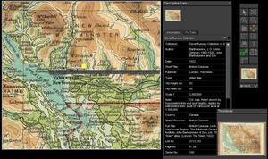
| by Flemming Funch Jon Udell quoting Alan Durning: Play back the last 10,000 years sped up, so that a millenium passes by every minute. For more than seven minutes, the screen displays what looks like a still photograph -- the blue planet Earth, its lands swathed in a mantle of trees. After seven and a half minutes, there's a tiny clearing of forest around Athens. This is the flowering of classical Greece. Little else changes. At nine minutes -- 1,000 years ago -- the forest gets thinner in parts of Europe, Central America, China and India. Twelve seconds from the end, two centuries ago, the thinning spreads a little farther in Europe and China. Six seconds from the end, eastern North America is deforested. This is the Industrial Revolution.And of course, in the last 3 seconds things get to look really alarming.  Anyway, Jon talks about David Rumsey, a philanthropist who collects historical maps, scans them at high resolution, and makes them freely viewable on the Internet. He gave a speech at an open source conference. He says: Anyway, Jon talks about David Rumsey, a philanthropist who collects historical maps, scans them at high resolution, and makes them freely viewable on the Internet. He gave a speech at an open source conference. He says:I thought about donating it to a university, but their libraries focus on preservation, they'd have put my collection in a vault and there would have been no access. Along comes the Internet, and I found we could do even more with the digital content than with the originals. We serve over 7000 visitors a day. A typical map library will serve 200 visitors a year.Historical maps, who cares about that? Well, he's apparently put a lot of work into providing some very impressive high tech tools for exploring them. One can sequence maps for different time periods, to see how things change. One can overlay maps on each each other, including overlaying old maps on modern 3D elevation maps, and you can then take a virtual flythru through an old map. Maps are a good thing when they help us see the world and our history more clearly. Which they do much better in online interactive form than as paper in the basement of a university. |